أهلا وسهلا بك زائرنا الكريم في JO1R FORUM | منتديات شباب و صبايا الأردن، لكي تتمكن من المشاركة ومشاهدة جميع أقسام المنتدى وكافة الميزات ، يجب عليك إنشاء حساب جديد بالتسجيل بالضغط هنا أو تسجيل الدخول اضغط هنا إذا كنت عضواً .

اسف بدي اغلبكم شوي

انا تعودت منكم في هالمنتدى الاكثر من رائع انكم تساعدوني لما اكون بحاجة لاشي مثل موضووع الصور اللي عن حوادث السير وساعدتوني كتير مشكورين اكيد وهلا مع


06-05-2008 07:01 مساءً
معلومات الكاتب ▼
تاريخ الإنضمام : 22-08-2007
رقم العضوية : 574
المشاركات : 84
الجنس :
قوة السمعة : 3,652
انا تعودت منكم في هالمنتدى الاكثر من رائع انكم تساعدوني لما اكون بحاجة لاشي مثل موضووع الصور اللي عن حوادث السير وساعدتوني كتير مشكورين اكيد
وهلا مع اني مش حابة اتعبكم معي بدي مواضيع بتشمل الأردن لكن باللغة الانجليزية
ويا ريت اي حدا عندو موضوع بالانجليزي عن الاردن ينزلي اياه
توقيع :shoshoana
<font size="6"><font face="Impact">

look/images/icons/i1.gif اسف بدي اغلبكم شوي
  06-05-2008 07:03 مساءً   [1]
معلومات الكاتب ▼
تاريخ الإنضمام : 14-01-2008
رقم العضوية : 3,795
المشاركات : 5,309
الجنس :
قوة السمعة : 112,770
امممممممممممممممممممم طيب عن شو بدك الموضووع يتكلم يعني باي نااحيه
توقيع :(تعب الشوق )
515821411


تعب الشوووق

look/images/icons/i1.gif اسف بدي اغلبكم شوي
  06-05-2008 07:20 مساءً   [2]
معلومات الكاتب ▼
تاريخ الإنضمام : 04-07-2007
رقم العضوية : 1
المشاركات : 11,318
الدولة : Jordan
الجنس :
تاريخ الميلاد : 10-7-1986
قوة السمعة : 2,147,483,647
موقعي : زيارة موقعي
The seven hills of Amman are an enchanting mixture of ancient and modern. Honking horns give way to the beautiful call to prayer which echoes from the stately minarets which grace the city. Gleaming white houses, kabab stalls and cafés are interspersed with bustling markets—known in Arabic as souqs—and the remains of civilizations and ages long past. Sunset is perhaps the best time to enjoy Amman, as the white buildings of the city seem to glow in the fading warmth of the day. The greatest charm of Amman, however, is found in the hospitality of its residents. Visitors to Amman—and the rest of Jordan, for that matter—are continually surprised by the genuine warmth with which they are greeted. "Welcome in Jordan" is a phrase visitors will not soon forget.
jo_43
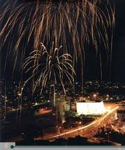
Amman at night.
© Zohrab
Amman is built on seven hills, or jabals, each of which more or less defines a neighborhood. Most jabals once had a traffic circle, and although most of these have now been replaced by traffic lights, Amman’s geography is often described in reference to the eight circles which form the spine of the city. First Circle is located near downtown, and the series extends westward through Eighth Circle.

jordan_bullet2 History
Amman has served as the modern and ancient capital of Jordan. It is one of the oldest continuously inhabited cities in the world, with a 1994 excavation uncovering homes and towers believed to have been built during the Stone Age, circa 7000 BCE. There are many Biblical references to the city, which by about 1200 BCE had become the Ammonite capital of Rabbath-Ammon. The Ammonites fought numerous wars with Saul, David and others.
The history of Amman between the end of its Biblical references (around 585 BCE) and the time of the Ptolemies is unclear. We do know that the city was renamed Philadelphia after the Ptolemaic ruler Philadelphus in the third century BCE. After coming under Seleucid and Nabatean rule, Philadelphia was taken by the Roman vassal King Herod in 30 BCE. The city became part of the Decapolis League, a loose alliance of ten Roman-ruled cities including Jerash, Gadara (present-day Umm Qais), Pella, Arbila (Irbid) and others. Under Roman rule, Philadelphia was replanned and reconstructed in typically grand Roman style with a colonnaded street, baths, an amphitheater and impressive public buildings.
During the Byzantine period, Philadelphia was the seat of a Christian bishop, and several expansive churches were built. The city declined somewhat during the late Byzantine years, and was overrun by the Persian Sassanians in 614 CE. Their rule was short-lived, however, collapsing before the Arabian armies of Islam around the year 635. The name of the city then returned to its Semitic origin of Ammon, or "Amman." It remained an important stop on the caravan routes for many years, but eventually trade patterns shifted and dried up the lifeblood of Amman. The city declined to little more than a provincial village for many centuries.
Amman’s "modern" history began in the late 19th century, when the Ottomans resettled a colony of Circassian emigrants there in 1878. Many of their descendants still reside in Amman. During that time and the early decades of the 20th century, the neighboring city of Salt was more important as a regional administrative and political center. However, after the Great Arab Revolt secured the state of Transjordan, Emir Abdullah bin al-Hussein made Amman his capital in 1921.
jo_110
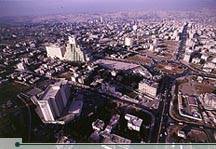
An aerial view of Amman. © Zohrab

Since then, the city has grown by leaps and bounds into a modern, thriving metropolis of well over a million people. Amman’s growth has been driven largely by political events in the region, and especially by the Arab-Israeli conflict. After the wars of 1948 and 1967, successive waves of Palestinian refugees ended up in Amman. Moreover, the city’s population was further expanded by another wave of immigrants arriving from Iraq and Kuwait during the 1990-91 Gulf Crisis.

jordan_bullet2 Sights of Interest
Most of Amman’s noteworthy historical sites are clustered in the downtown area, which sits at the bottom of four of Amman’s seven hills, or jabals. The ancient Citadel, which towers above the city from atop Jabal al-Qala’a, is a good place to begin a tour of the city. The Citadel is the site of ancient Rabbath-Ammon, and excavations here have revealed numerous Roman, Byzantine and early Islamic remains. The most impressive building of the Citadel, known simply as al-Qasr ("the Palace";), dates back to the Islamic Umayyad period. Its exact function is unclear, but it includes a monumental gateway, an audience hall and four vaulted chambers. A colonnaded street also runs through the complex. To the north and northeast are the ruins of Umayyad palace grounds.
Close to al-Qasr lie the remains of a small Byzantine basilica. Corinthian columns mark the site of the church, which is thought to date from the sixth or seventh century CE. About 100 meters south of the church is what is thought to have been a temple of Hercules, today also known as the Great Temple of Amman. The temple was built in the reign of the emperor Marcus Aurelius (161-180 CE), and is currently under restoration.
Also on Citadel Hill, just northwest of the Temple of Hercules, is the Jordan Archeological Museum. This small museum houses an excellent collection of antiquities ranging from prehistoric times to the 15th century. There is an exhibit of the Dead Sea Scrolls, a copy of the Mesha Stele (see Madaba section for explanation) and four rare Iron Age sarcophagi. Museum hours are 08:30-17:00 daily. On Fridays and official holidays the museum is open from 09:00-16:00.


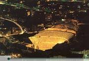
Downhill from the Citadel and five minutes walk east from downtown, the Roman Theater is the most obvious and impressive relic of ancient Philadelphia. The theater, which was built during the reign of Antonius Pius (138-161 CE), is cut into the northern side of a hill that once served as a necropolis—or graveyard. It is very similar in design to the amphitheater at Jerash, and can accommodate 6000 spectators. The theater is still used periodically for sporting and cultural events.
jo_44b
The Roman Amphitheater in downtown Amman.


Two small museums are built into the foundations of the Roman theater. The Jordan Folklore Museum is in the right wing of the theater and displays a collection of items showing the traditional life of local people. At the other end of the theater stage, the Museum of Popular Traditions displays traditional Jordanian costumes, including fine embroidery and beautiful antique jewelry. It also houses several sixth-century mosaics from Madaba and Jerash. The Museum of Popular Traditions is open daily 09:00-17:00, and closed on Tuesday. The Jordan Folklore Museum is open every day from 09:00-17:00, except Friday when its hours are 10:00-16:00.
To the northeast stands the small theater, or Odeon, which is still being restored. Built at about the same time as the Roman theater, this intimate 500-seat theater is used now as it was in Roman times, for musical concerts. Archaeologists think that the building was originally covered with a wooden or temporary tent roof to shield performers and audiences from the elements. Heading southwest from the theater complex, Philadelphia’s chief fountain, or Nymphaeum, stands with its back to Quraysh Street. Much of the fountain, which was completed in 191 CE, is hidden from public view by private houses and shops. The Nymphaeum is believed to have contained a 600 square meter pool, three meters deep, which was continuously refilled with fresh water. Jordan’s Department of Antiquities is currently excavating the Nymphaeum, and ultimately hopes to restore the site to its original structure by 2010.

jo_44
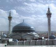
The King Abdullah Mosque, Amman.
From the Nymphaeum, the short stroll to the King Hussein Mosque bustles with pedestrians, juice stands and vendors. The area around the King Hussein Mosque, also known as al-Husseini Mosque, is the heart of modern downtown Amman. The Ottoman-style mosque was rebuilt in 1924 on the site of an ancient mosque, probably also the site of the cathedral of Philadelphia. Between the al-Husseini Mosque and the Citadel is Amman’s famous gold souq, which features row after row of glittering gold treasures.
توقيع :JO1R
:no::no::no::no:

look/images/icons/i1.gif اسف بدي اغلبكم شوي
  06-05-2008 07:21 مساءً   [3]
معلومات الكاتب ▼
تاريخ الإنضمام : 22-08-2007
رقم العضوية : 574
المشاركات : 84
الجنس :
قوة السمعة : 3,652
شكرا على اهتمام ــ المارشال
ما في موضوع محدد او عن الطبيعة عن القيادة عن الاثار اي اشي بعدين اي شي منك حلو
توقيع :shoshoana
<font size="6"><font face="Impact">

look/images/icons/i1.gif اسف بدي اغلبكم شوي
  06-05-2008 07:21 مساءً   [4]
معلومات الكاتب ▼
تاريخ الإنضمام : 04-07-2007
رقم العضوية : 1
المشاركات : 11,318
الدولة : Jordan
الجنس :
تاريخ الميلاد : 10-7-1986
قوة السمعة : 2,147,483,647
موقعي : زيارة موقعي
South of Amman
Petra
jo_video

Undoubtedly the most famous attraction in Jordan is the Nabatean city of Petra, nestled away in the mountains south of the Dead Sea. Petra, which means "stone" in Greek, is perhaps the most spectacular ancient city remaining in the modern world, and certainly a must-see for visitors to Jordan and the Middle East.The city was the capital of the Nabateans -Arabs who dominated the lands of Jordan during pre-Roman times- and they carved this wonderland of temples, tombs and elaborate buildings out of solid rock. The Victorian traveler and poet Dean Burgon gave Petra a description which holds to this day -"Match me such a marvel save in Eastern clime, a rose-red city half as old as time." Yet words can hardly do justice to the magnificence that is Petra. In order to best savor the atmosphere of this ancient wonder, visit in the quiet of the early morning or late afternoon when the sandstone rock glows red with quiet grandeur.

jo_63
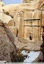
Petra in snow. © Jad Al Younis, Discovery Eco-Tourism

For seven centuries, Petra fell into the mists of legend, its existence a guarded secret known only to the local Bedouins and Arab tradesmen. Finally, in 1812, a young Swiss explorer and convert to Islam named Johann Ludwig Burckhardt heard locals speaking of a "lost city" hidden in the mountains of Wadi Mousa. In order to find the site without arousing local suspicions, Burckhardt disguised himself as a pilgrim seeking to make a sacrifice at the tomb of Aaron, a mission which would provide him a glimpse of the legendary city. He managed to bluff his way through successfully, and the secret of Petra was revealed to the modern Western world.Much of Petra’s fascination comes from its setting on the edge of Wadi Araba. The rugged sandstone hills form a deep canyon easily protected from all directions. The easiest access to Petra is through the Siq, a winding cleft in the rock that varies from between five to 200 meters wide. Petra’s excellent state of preservation can be attributed to the fact that almost all of its hundreds of "buildings" have been hewn out of solid rock: there are only a few free-standing buildings in the city. Until 1984, many of these caves were home to the local Bedouins. Out of concern for the monuments, however, the government outlawed this and relocated the Bedouins to housing near the adjacent town of Wadi Mousa.


Petra is located just outside the town of Wadi Mousa in southern Jordan. It is 260 kilometers from Amman via the Desert Highway and 280 kilometers via the King’s Highway. There are numerous and varied accommodations available in Wadi Mousa, as well as a few hotels on the panoramic drive between Wadi Mousa and the nearby (15 kilometers) village of Taybet. Camping is now illegal inside Petra.

jordan_bullet2 History
Archaeologists believe that Petra has been inhabited from prehistoric times. Just north of the city at Beidha, the remains of a 9000-year-old city have been discovered, putting it in the same league as Jericho as one of the earliest known settlements in the Middle East. Between that time and the Iron Age (circa 1200 BCE), when it was the home of the Edomites, virtually nothing is known. The Bible tells of how King David subdued the Edomites, probably around 1000 BCE. According to this story, the Edomites were enslaved, but eventually won their freedom. A series of great battles were then fought between the Judeans and the people of Edom. In one of these, the Judean King Amaziah, who ruled from 796 to 781 BCE, "defeated ten thousand Edomites in the Valley of Salt, and captured Sela in battle" (2 Kings 14: 25). The summit of Umm al-Biyara mountain, in central Petra, is often identified as the Sela of the Bible. However, Sela is also sometimes identified as the mountaintop stronghold of Sele, near Buseirah, one of the Edomite capitals north of Petra.
The area’s principle water source, Ain Mousa (Spring of Moses), is thought by some to be one of the many places where the Prophet Musa (Moses) struck a rock with his staff to extract water (Numbers 20: 10-13). Prophet Aaron, brother of Moses and Miriam, died in the Petra area and was buried atop Mount Hor, now known as Jabal Haroun (Mount Aaron).


Sometime during the sixth century BCE, a nomadic tribe known as the Nabateans migrated from western Arabia and settled in the area. It appears as though the Nabatean migration was gradual and there were few hostilities between them and the Edomites. As the Nabateans forsook their nomadic lifestyle and settled in Petra, they grew rich by levying taxes on travelers to ensure safe passage through their lands. The easily defensible valley city of Petra allowed the Nabateans to grow strong.
jo_125
Petra. © Zohrab


From its origins as a fortress city, Petra became a wealthy commercial crossroads between the Arabian, Assyrian, Egyptian, Greek and Roman cultures. Control of this crucial trade route between the upland areas of Jordan, the Red Sea, Damascus and southern Arabia was the lifeblood of the Nabatean Empire and brought Petra its fortune. The riches the Nabateans accrued allowed them to carve monumental temples, tombs and administrative centers out of their valley stronghold.The Seleucid King Antigonus, who had come to power in Babylonia when Alexander the Great’s empire was divided, rode against the Nabateans in 312 BCE. The Nabateans eventually repelled the invaders, and records indicate that they were eager to remain on good terms with the Seleucids in order to perpetuate their trading ambitions. While the Seleucids could not conquer the Nabateans militarily, their Hellenistic culture made a lasting impact upon the Nabateans. New ideas in art and architecture influenced the Nabateans at the same time that their flourishing empire was expanding northward into Syria, around 150 BCE. The term "empire" is used loosely here, for it was more a zone of influence. As the Nabateans expanded northward, more caravan routes and, consequently, trading riches, came under their control. It was primarily this, rather than territorial acquisition or cultural domination, that motivated them.
The growing economic and political power of the Nabateans began to worry the Romans, and in 63 BCE Pompey dispatched a force to cripple Petra. Nabatean King Aretas III either defeated the Roman Legions or paid a tribute to keep peace with them. Later, the Nabateans made a mistake by siding with the Parthians in their war with the Romans. After the Parthians’ defeat, Petra had to pay tribute to Rome. When they fell behind in paying this tribute, they were invaded twice by the Roman vassal King Herod the Great. The second attack, in 31 BCE, saw him take control of a large swath of Nabatean territory, including the lucrative northern trading routes into Syria. With their trading empire reduced to a shell of its former glory, the Nabatean Empire staggered on for almost another century and a half. The last Nabatean monarch, Rabbel II, struck a deal with the Romans that as long as they did not attack during his lifetime, they would be allowed to move in after he died. Upon his death in 106 CE, the Romans claimed the Nabatean Kingdom and set about transforming it with the usual plan of a colonnaded street, baths, and the common trappings of modern Roman life.
Much of what is known about Nabatean culture comes from the writings of the Roman scholar Strabo. He recorded that their community was governed by a royal family, although a spirit of democracy prevailed. Strabo also notes the materialism of the Nabateans.
With its incorporation into the Roman Empire, Petra began to thrive once again. The city may have housed 20,000-30,000 people during its heyday. The fortunes of Petra began to decline with the shift in trade routes to Palmyra in Syria and the expansion of seaborne trade around Arabia. The city was struck another blow in 363 CE, when the free-standing structures of Petra were thrown to the ground in a violent earthquake. Fortunately, Petra’s greatest constructions were preserved, carved as they are into the rock faces.
It is not known whether the inhabitants of Petra left the city before or after the fourth century earthquake. The fact that very few silver coins or valuable possessions have been unearthed at Petra indicates, however, that the withdrawal was an unhurried and organized process. One theory holds that the city of Petra was primarily a religious and administrative center, used occasionally as a fortress during times of war. The preponderance of temples and tombs supports this theory, which holds that as the dead began to consume more and more of Petra’s space, the living relocated to other caves or tents outside the inner confines of the "holy" city.
It seems clear that by the time of the Muslim conquest in the seventh century CE, Petra had slipped into obscurity. The city was damaged again by the earthquake of 747 CE, and housed a small Crusader community during the 12th or 13th century. It then passed into obscurity and was forgotten until Johann Ludwig Burckhardt rediscovered it for the outside world in 1812.


jordan_bullet2 Sights of Interest
The entrance to Petra is just past the town of Wadi Mousa. Petra is open from roughly 06:00 until 18:00, and 20 dinars is the cost of a one-day adult ticket for non-Jordanians. From the Government Rest House, where you can stock up with film, a map of the ancient city, food and souvenirs, the path leads down to the Siq (the narrow winding valley that leads in to Petra). There you will see dozens of local Bedouins with horses that you can hire to transport you the 1.5 kilometers or so down to the actual Siq.
Even before you reach the Siq, you will notice three square free-standing tombs on your right. No evidence of bones has been found, but it may be that these are a type of tombstone. Further along on the left, built high into the cliff, stands the Obelisk Tomb, which once stood seven meters high. Five graves were found inside the tomb, four represented by pyramid-shaped pillars and the last by a statue between the middle pillars. Closer to the Siq, rock-cut channels once brought the waters of Ein Mousa through ceramic pipes to the inner city as well as to the surrounding farm country. When designing a new dam, excavators uncovered the Nabateans’ ancient dam and used it as a model for the modern one.
As you enter the Siq, the path narrows to about five meters and the walls tower over 200 meters overhead, casting enormous shadows on the niches that once held icons of the gods Dushara and al-Uzza. The icons were meant to protect the entrance and hex unwelcome visitors. The entrance to the Siq was once topped by a ceremonial arch built by the Nabateans. It survived until the late ninth century, and you can still see remains of it as you enter the gorge. The original channels cut in the walls to bring water into Petra can also be seen, and in some places the original terracotta pipes are still in place.


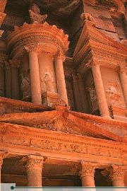
After winding around for 1.5 kilometers, the Siq suddenly opens upon the most impressive of all Petra’s monuments -al-Khazneh (Arabic for "the Treasury";). One of the most elegant remains of antiquity, it is carved out of solid rock from the side of a mountain, and stands over 40 meters high. Although it served as a royal tomb, the Treasury gets its name from the legend that pirates hid their treasure there, in a giant stone urn which stands in the center of the second level. Believing the urn to be filled with ancient pharoanic treasures, the Bedouins periodically fired guns at it: proof of this can be seen in the bullet holes which are clearly visible on the urn. Much speculation has gone into the barely distinguishable reliefs which can be seen on the exterior of the Khazneh, although consensus is that they represent various gods. The Khazneh’s age has also been debated, with estimates ranging from 100 BCE to 200 CE.
jo_64
"Al-Khazneh", the Treasury, Petra. © Michelle Woodward

As the Siq turns right and leads down toward the city, the number of niches and tombs increases, becoming a virtual graveyard in rock arching around behind the 8000-seat Amphitheater. Originally thought to have been built by the Romans after their defeat of the Nabateans in 106 CE, it is now believed that the Nabateans cut the Amphitheater out of the rock around the time of Christ, slicing through many caves and tombs in the process. Under the stage floor were store rooms and a slot through which a curtain could be lowered at the beginning of a performance. Through this slot a marble Hercules was discovered several years ago.After the Amphitheater, the wadi widens out and you soon come to the main city area, which covers about three square kilometers. Up on the right, carved into the rock of Jabal Khubtha, are the Royal Tombs. The first is the Urn Tomb, with its open terrace built over a double layer of vaults. The room inside measures 20 by 18 meters, and the patterns in the rock are striking. The Urn Tomb commands an impressive view and was once used as a church in Byzantine times. Next along is the Corinthian Tomb, allegedly a replica of Nero’s Golden Palace in Rome. Finally, the Palace Tomb is a three-story imitation of a Roman palace and one of the largest monuments in Petra. The tomb had to be completed by attaching preassembled stones to its upper left-hand corner. Around the corner to the right is the Mausoleum of Sextus Florentinius, a Roman administrator under Emperor Hadrian.
Continuing down the Siq, several restored columns mark the sides of the paved Roman colonnaded street. During the Roman era, columns lined the full length of the street, with markets and residences branching off on the sides. The slopes of the hills on either side are littered with the remains of the ancient city.
Along the colonnaded street you will see the ruins of the public fountain, or Nymphaeum. At the northwestern end of the colonnaded street is the triple-arched Temenos Gateway, which was originally fitted with wooden doors and marked the entrance into the courtyard, or "temenos", of the Qasr al-Bint. To the right of the Temenos Gateway, or Triumphal Arch, is the Temple of the Winged Lions. This was named after the carved lions that adorn the capitals of the columns. The temple was dedicated to the fertility goddess Atargatis, who was the partner to the main male god, Dushara.
Several hundred meters to the right of the street, near the Temple of the Winged Lions, is an immense Byzantine Church rich with mosaics. Each of the side aisles of Petra Church is paved with 70 square meters of remarkably preserved mosaics, depicting native as well as exotic or mythological animals, as well as personifications of the Seasons, Ocean, Earth and Wisdom. The church is thought to have been a major fifth- and sixth-century cathedral, throwing into question theories of Petra’s decline during this era. In December 1993, a cache of 152 papyrus scrolls in Byzantine Greek and possibly late Arabic were uncovered at the site. The scrolls, which constitute the largest group of written material from antiquity found in Jordan, are currently being deciphered and are yielding a wealth of information concerning the Byzantine period in the area. The Petra Church and its mosaics are currently being excavated and preserved.
Passing through the Temenos Gateway, one enters the piazza of the Qasr bint al-Faroun (in Arabic, "Palace of the Pharoah’s Daughter";). This Nabatean construction dates from around 30 BCE, and is also known as the Temple of Dushara, after the god who was worshipped there. It was probably the main place of worship in Nabatean Petra, and it is the only freestanding structure in Petra. The Qasr was in use up until the Roman annexation, when it was burned. Earthquakes in the fourth and eighth centuries destroyed the remainder of the building.
Just beyond the Qasr al-Bint is the small massif of al-Habis. Steps lead up to the small, free museum which has a collection of artifacts found in Petra over the years.


jordan_bullet2 The High Places
There are a number of places in Petra that require a bit of effort to reach, but the effort is well worth the spectacular views that await. As well as the following climbs, you can make the longer hikes to Umm al-Biyara—which may be the biblical precipice of Sela (2 Kings 14: 7; Isaiah 16: 1)—, al-Beidha, or the six-hour hike to the top of Mt. Hor and Aaron’s Tomb (in Arabic, Jabal Haroun). For these climbs either a detailed guidebook with maps or an actual guide is recommended. As always, bring plenty of water.
The easiest of these climbs is up to the Crusader castle, or Citadel, on top of al-Habis. The steps leading to the top start from the base of the hill on the rise behind the Qasr Bint al-Faroun. The path goes all the way around al-Habis, revealing more caves on its western side. The entire round trip hike takes less than an hour.


jo_64b
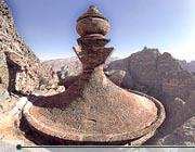
"Al-Deir", the Monastery, Petra.
© Mouasher

From the Qasr, it takes around an hour to reach one of Petra’s most spectacular constructions, al-Deir ("The Monastery";). To truly experience Petra’s immensity and power, a visit here is essential. The climb leads up the hillside, but the ancient path is easy to follow and not steep. Not far along the track, a sign points left to the Lion Tomb, set in a small gully. The two lions that give it its name can be seen facing each other at the base of the tomb.

The Monastery itself is similar in appearance to the Khazneh, but, at 50 meters wide and 45 meters tall, it is far bigger. Undertaken between the third century BCE and the first century CE, but never completed, it is less ornate than the Khazneh. The Monastery receives its name from crosses on the inside walls that suggest it was later used as a church. Al-Deir’s primary distinguishing feature is its crowning urn, which, unlike the Khazneh, is not backed against the rock. The urn can be reached via a series of ancient steps which connect the left of the facade with the rim of the urn. The views from on top are simply stunning.
One of the more popular hikes is the High Place of Sacrifice. This one-and-a-half hour trip is best done in the early morning with the sun behind you. Coming from the Khazneh, steps head up to the left just as the Amphitheater comes into view. Follow the right prong when the trail levels and forks at the top of the stairs. The top of the ridge has been flattened into a platform, and two large depressions with drains show where the blood of sacrificial animals flowed out. There are also altars cut into the rock, along with obelisks and the remains of buildings used to house the priests. The path then leads down to the Lion Fountain. A stone altar opposite the fountain suggests that it originally had a religious function. The first complex beyond this is the Garden Tomb, which archaeologists believe was more likely a temple. Below this is the Tomb of the Roman Soldier and the Triclinium (Feast Hall), which has the only decorated interior in Petra. The track then flattens out and leads by the site of ancient rubbish dumps, ending up at the Pharaon Column, the only surviving column of another temple.
jo_123
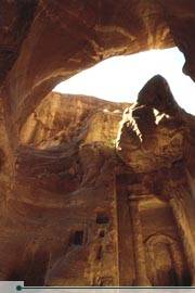
Siq al-Bared, north of the popular Siq of Petra. © Ammar Khammash
توقيع :JO1R
:no::no::no::no:

look/images/icons/i1.gif اسف بدي اغلبكم شوي
  06-05-2008 07:24 مساءً   [5]
معلومات الكاتب ▼
تاريخ الإنضمام : 22-08-2007
رقم العضوية : 574
المشاركات : 84
الجنس :
قوة السمعة : 3,652
jo1r
تعبتك معي وعن جد شكرا كتيييييييييييييير
الموضوع كتير كويس ومنيح[SIZE="6][/SIZE]
توقيع :shoshoana
<font size="6"><font face="Impact">

look/images/icons/i1.gif اسف بدي اغلبكم شوي
  06-05-2008 07:25 مساءً   [6]
معلومات الكاتب ▼
تاريخ الإنضمام : 04-07-2007
رقم العضوية : 1
المشاركات : 11,318
الدولة : Jordan
الجنس :
تاريخ الميلاد : 10-7-1986
قوة السمعة : 2,147,483,647
موقعي : زيارة موقعي
Near Amman
jordan_bullet2 Salt
The town of Salt was of great importance in the 19th and early 20th century, during the time of Turkish rule in Jordan. It was the chief administrative center for the surrounding area and, in the 1920s, it seemed the likely choice for the capital of the newly-independent state of Transjordan. However, Salt was bypassed in favor of the more centrally located village of Amman. The result is that Amman has been transformed into a thriving modern city, while Salt has retained its small town charm.

jo_45
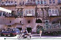
The architecture of Salt. © Zohrab


Due to its history as an Ottoman center of government, Salt is filled with wonderful Ottoman architecture in the classical style. Immediately recognizable are the Ottoman houses with their long-arched windows. An array of tall Ottoman minarets towers over the village, along with church steeples, as Salt is also known for its Christian community. A morning or evening spent strolling through the picturesque streets of this charming hill village is time well spent.Salt is also the final resting place of the Prophet Ayyoub (Job), whose legendary patience and faith gave him strength to endure tremendous hardships and ultimately be rewarded with blessings (Job 1-3, Quran 38: 41-44). Another prophet—Shuayb (Jethro), the Midianite father-in-law of Prophet Musa (Moses)—is said to be buried in a tomb near Salt in Wadi Shuayb.
Salt is about thirty kilometers northwest of Amman. Just before you enter the main part of the city (from Amman), you will see the Department of Antiquities Museum and the Tourist Office on the left. The museum houses an assortment of pottery and coins dating from the Chalcolithic period (4500 BCE) through the Mamluk period (1516 CE), as well as Byzantine mosaic panels and early photographs of Salt. The museum is open 08:00-14:00 every day except Friday. Entrance is free. Just off the main street is the Salt Cultural Center. This complex, which opened in 1989, houses another museum, a library, a handicraft school and Salt’s main hall. The handicraft school teaches ceramics, weaving, silk screen printing and dyeing to students, who then sell their craftwork, making the project self-financing. The project is sponsored by the Noor al-Hussein Foundation and the Salt Development Foundation.


jo_line


jordan_bullet2 Wadi Seer
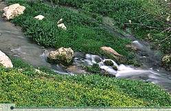
Around 24 kilometers southwest of Amman, the high desert plateau suddenly gives way to the lush, tree-covered valley of Wadi Seer. About 10 kilometers past the village of Wadi Seer, which was settled largely by fair-skinned, red-headed Circassians, the road leads to the ruins of Qasr al-Abd (Castle of the Slave) and the ancient caves of ‘Iraq al-Amir (Caves of the Prince).

jo_46
Wadi Seer. © Zohrab
Local legend has it that Qasr al-Abd was built by a love-smitten slave named Tobiah. While his master was away on a journey, Tobiah built a palace and carved lions, panthers and eagles on its walls in order to win the love of his master’s daughter. Unfortunately, the master returned before Tobiah could finish the work, and the slave’s efforts went unrequited.Little is known for sure about the actual history of this castle, but it is widely believed to have been built in the second century BCE by Hyrcanus, head of the powerful Tobiad family and governor of Ammon. The name "Castle of the Slave" may thus refer to Hyrcanus himself, who, as governor, was a "slave of the people." The first-century historian Josephus recorded the wealth of the Tobiad family and the exploits of Hyrcanus, who built a strong fortress of white stone which was decorated with carvings of "animals of a prodigious magnitude." Perhaps the most interesting part is the north entrance, with one of the original carved animals, a giant stone lion, peering down over all who pass underneath. The entire building was once covered with such figures.
The estate was originally surrounded by a wall and included a lake and a park with trees and shrubs. The castle itself is unique, in that it was built from some of the largest blocks of any building in the Middle East. The largest block measures seven by three meters, but as most were only about 40 centimeters wide, the whole construction was quite flimsy. An earthquake in 362 CE completely flattened the palace.
The ruins of Qasr al-Abd have been partially restored, thanks to the efforts of a French archeologist who spent three years making detailed drawings of the fallen stones. After having made cardboard cutouts of each stone and piecing the "jigsaw puzzle" together, he then spent another seven years on the actual reconstruction. The result is a fine monument which has, so far, remained mostly undiscovered by tourists.
As you return up the valley, stop around 500 meters from the Qasr. On the left you will find a group of caves cut from the rock. These are known as ‘Iraq al-Amir. The caves, eleven in total, are arranged in two tiers and are thought to be man-made. They were once used as cavalry stables, while the villagers today use them to house their goats and store chaff. At the front of one of the caves, easily recognizable by its carved doorway, the word "Tobiad" is engraved in Aramaic. This gives credence to the theory that Qasr al-Abd was built by the Tobiad family.
توقيع :JO1R
:no::no::no::no:

look/images/icons/i1.gif اسف بدي اغلبكم شوي
  06-05-2008 07:26 مساءً   [7]
معلومات الكاتب ▼
تاريخ الإنضمام : 04-07-2007
رقم العضوية : 1
المشاركات : 11,318
الدولة : Jordan
الجنس :
تاريخ الميلاد : 10-7-1986
قوة السمعة : 2,147,483,647
موقعي : زيارة موقعي
North and West of Amman
jordan_bullet2 Jerash
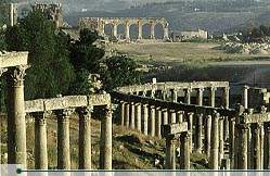
Jerash, located 48 kilometers north of Amman is considered one of the largest and most well-preserved sites of Roman architecture in the world outside Italy. To this day, its colonnaded streets, baths, theaters, plazas and arches remain in exceptional condition. Within the remaining city walls, archaeologists have found the ruins of settlements dating back to the Neolithic Age, indicating human occupation at this ،،،،،،،، for more than 6500 years. This is not surprising, as the area is ideally suited for human habitation.

jo_47
Jerash.
© Zohrab

jo_48b
The Theatre at Jerash.
© Zohrab
Jerash is fed year-round with water, while its altitude of 500 meters gives it a temperate climate and excellent visibility over they surrounding low-lying areas.The history of Jerash is a blend of the Greco-Roman world of the Mediterranean basin and the ancient traditions of the Arab Orient. Indeed, the name of the city itself reflects this interaction. The earliest Arab/Semitic inhabitants, who lived in the area during the pre-classical period of the first millenium BCE, named their village Garshu. The Romans later Hellenised the former Arabic name of Garshu into Gerasa, and the Bible refers to "the region of the Gerasenes" (Mark 5:1; Luke 8:26). At the end of the 19th century, the Arab and Circassian inhabitants of the small rural settlement transformed the Roman Gerasa into the Arabic Jerash.


It was not until the days of Alexander the Great that Jerash truly began to prosper. After falling under the rule of the Seleucid King Antioch in the second century BCE, Jerash was conquered by the Roman Emperor Pompey in 63 BCE. It was during the period of Roman rule that Jerash, then known as Gerasa, enjoyed its golden age. The Romans assimilated Jerash into the province of Syria, and later named it as one of the great cities of the Decapolis League. The Decapolis was a prosperous confederation of ten Roman cities formed during the first century BCE, and linked by powerful commercial, political and cultural interests. Pliny mentioned the confederation in his Natural History, listing the cities as Damascus, Philadelphia (now Amman), Gerasa (Jerash), Scythopolis (Beisan), Gadara (Umm Qais), Hippos, Dion, Pella, Canatha and Raphana.Over the next century and a half, trade flourished with the Nabateans and Jerash prospered. The city also benefited from the rich surrounding farmlands and from iron ore mining in the Ajloun area. This period saw the implementation of a typically Roman city plan featuring a colonnaded main street intersected by two side streets.
In 106 CE, the Emperor Trajan annexed the wealthy Nabatean kingdom and formed the province of Arabia. The Romans secured lines of communication and trade with the Via Nova Triana (Trajan New Road), which was built between 112-114 CE and stretched all the way from Syria to Aqaba. With even greater trading riches pouring in, Jerash enjoyed another burst of construction activity. Granite was brought from as far away as Aswan (Egypt), and old temples were razed and rebuilt according to the latest architectural fashion.


The city received yet another boost in stature with the visit of Emperor Hadrian in 129 CE. To honor its guest, the citizens raised a monumental Triumphal Arch at the southern end of the city. Jerash’s prosperity reached a peak in the beginning of the third century, when the rank of Roman Colony was bestowed upon it. During this "golden age," Jerash may have had a population of 20,000 people. The ancient city preserved today was the administrative, civic, commercial and cultural center of this community, while the bulk of the city’s citizens lived on the east side of Wadi Jerash.
jo_48
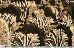
Close-up of Jerash columns with detail of carved canthes leaves.
© Michelle Woodward

As the third century progressed, shipping began to supplant overland caravans as the main route for commerce. Jerash thus fell into decline as its previously lucrative trade routes became less traveled and less valuable. This trend was speeded by frequent uprisings against the Romans—such as the destruction of Palmyra in 273 CE—that made the overland routes more dangerous.In the year 330 CE, Emperor Constantine converted to Christianity and proclaimed it the state religion of the empire’s eastern, or Byzantine, half. By the middle of the fifth century, Christianity had become the major religion of the region and numerous churches were constructed in Jerash. In fact, most of these were built of stones taken from pagan temples. No more churches were built after the year 611 CE.
Jerash was hit further by the Persian invasion of 614 CE, which also sacked Damascus and Jerusalem, and by the Muslim conquest of 636 CE. The city was rocked again in the year 747 CE by a series of earthquakes, and its population shrunk to about 4000. Although the site was occupied in the early Islamic period until around 800 CE, Jerash was nothing more than a small rural village.
The Crusaders described Jerash as uninhabited, and it remained abandoned until its rediscovery in 1806, when Ulrich Jasper Seetzen, a German traveler, came across and recognized a small part of the ruins. The ancient city was buried in sand, which accounts for its remarkable preservation. It has been gradually revealed through a series of excavations which commenced in 1925, and continue to this day.
Tickets to the ruins are available at the Jerash Visitors’ Center at the South Gate. There, you can also find free maps of Jerash as well as souvenir shops selling guidebooks and trinkets. The ruins are open from around 07:00 until dark. From July through October, sound and light shows take place from 20:30-22:30. Call the Visitors’ Center (tel. 02-635-1014) for details.
jo_47b
Jerash Festival.
© Zohrab
Visitors to Jerash in late July or early August can enjoy the Jerash Festival of Culture and Arts an exciting celebration of both Jordanian and international culture. The ancient Roman amphitheater comes to life once more as dancers, musicians, acrobats, theatrical troupes and others from all over the world come to celebrate the link between ancient and modern culture in Jor
توقيع :JO1R
:no::no::no::no:

look/images/icons/i1.gif اسف بدي اغلبكم شوي
  06-05-2008 07:41 مساءً   [8]
معلومات الكاتب ▼
تاريخ الإنضمام : 22-08-2007
رقم العضوية : 574
المشاركات : 84
الجنس :
قوة السمعة : 3,652
عن جد نشامى بينرفع الراس فيكم وهالشي مش غريب عالاردنية اهل الاصالة والنخوة والفزعة ...
توقيع :shoshoana
<font size="6"><font face="Impact">

اضافة رد جديد اضافة موضوع جديد


المواضيع المتشابهه
عنوان الموضوع الكاتب الردود الزوار آخر رد
حقيقي اسف G-H-A-I-T-H
242 4154 احلى دلوعه
وزارة المياه تنفق 47 ألف دينار على المناسف والكنافة والاراجيل بمشروع سد الوحدة امير النور
0 151 امير النور
5 قتلى ونحو 30 جريحا بانفجار متزامن لثلاث عبوات ناسفة في بغداد إصلاح نيوز
0 199 إصلاح نيوز
المفرق: 5 إصابات في حريق مصنع اسفنج مراسل عمان نت
0 197 مراسل عمان نت
5 إصابات نتيجة حريق بمستودع مصنع اسفنج في المفرق إصلاح نيوز
0 181 إصلاح نيوز

الكلمات الدلالية
لا يوجد كلمات دلالية ..


الساعة الآن 07:04 PM